


antique maps and cartography
Antique maps Cartography and Travel. Aventure who discovered the world. See our antique world maps and antique globes.
-
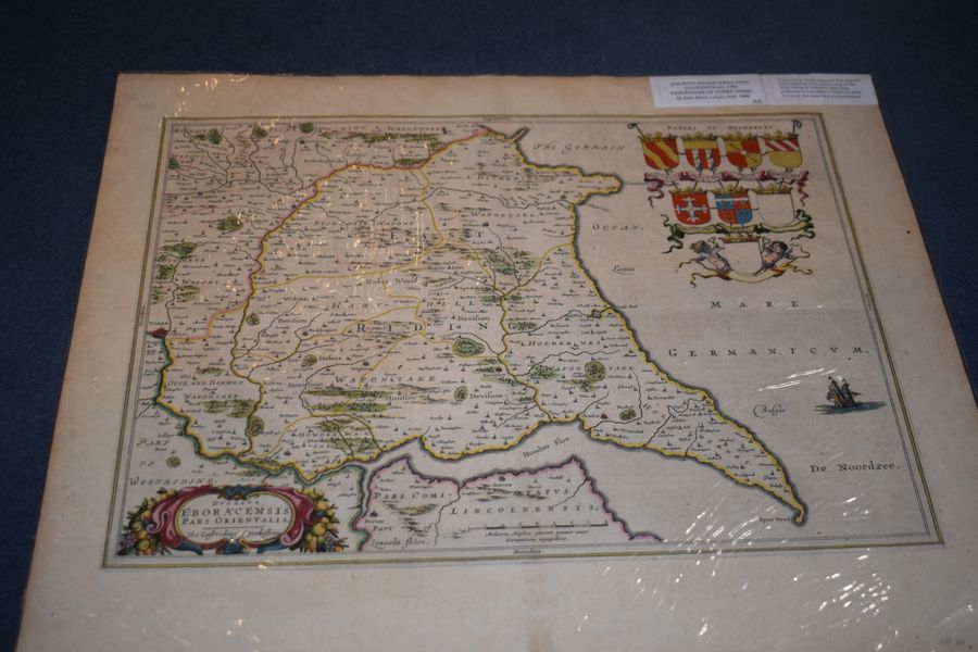
Ducatus Eboracensis pars occidentalis; The Westriding of Yorke Shire.' by Joan Blaeu c. 1645-1648
lansdowne antiques, dorking, united kingdom
Ducatus Eboracensis pars occidentalis; The Westriding of Yorke Shire.' by Joan Blaeu c. 1645-1648 A decorative, finely engraved and superbly hand coloured 17th century map of the West Riding of Yorkshire which was published in...
£350.00
view details -
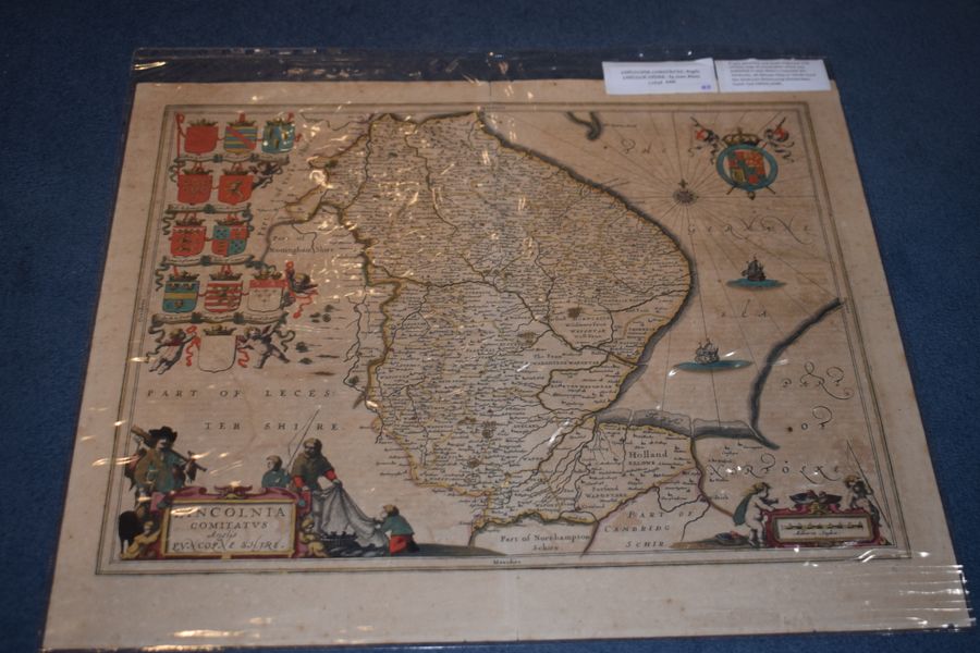
Lincoln Comitatus. Anglis Lincoln-Shire. by Joan Blaeu
lansdowne antiques, dorking, united kingdom
Lincoln Comitatus. Anglis Lincoln-Shire. by Joan Blaeu 1648. A very attractive and finely engraved 17th century map of Lincolnshire which was published in Joan Blaeu's Toonneel des Aerdrycks, oft Nieuwe Atlas or Vierde Stuck Der...
£325.00
view details -
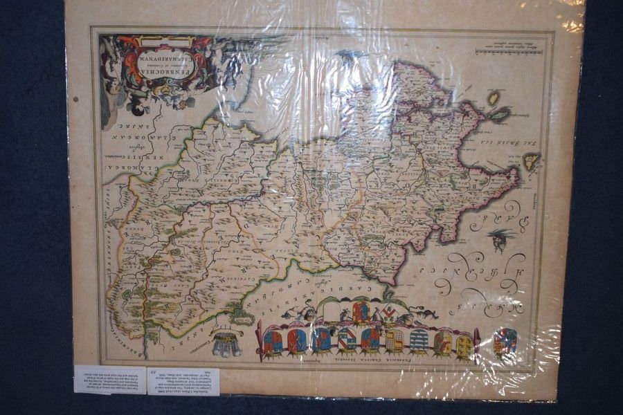
Penbochia J. Blaeu 1645-1648. Cardigan to Llanethly
lansdowne antiques, dorking, united kingdom
Penbochia J. Blaeu 1645-1648. Cardigan to Llanethly. This attractive map of Pembrokeshire and Carmarthenshire was published in "Guil. et Ioannis Blaeu Theatrum Orbis Terrarum, sive Atlas Novus - Part IV", Amsterdam, Joan Blaeu, 1645, 1646....
£350.00
view details